Integrating GIS With Marsh Restoration in Southern Maine
by Joel Soloway
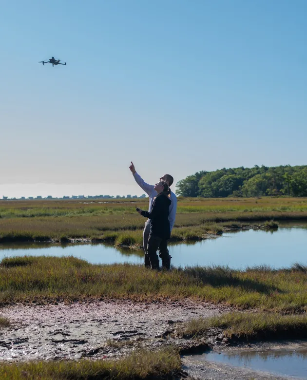
As a drone hums above UNE’s coastal Biddeford Campus, the salty sea breeze mingles with the faint aroma of freshly cut grass. One might wonder how this high-flying marvel works to protect the serene salt marsh below.
Katie DeWater, a senior studying Marine Sciences, has the answer.
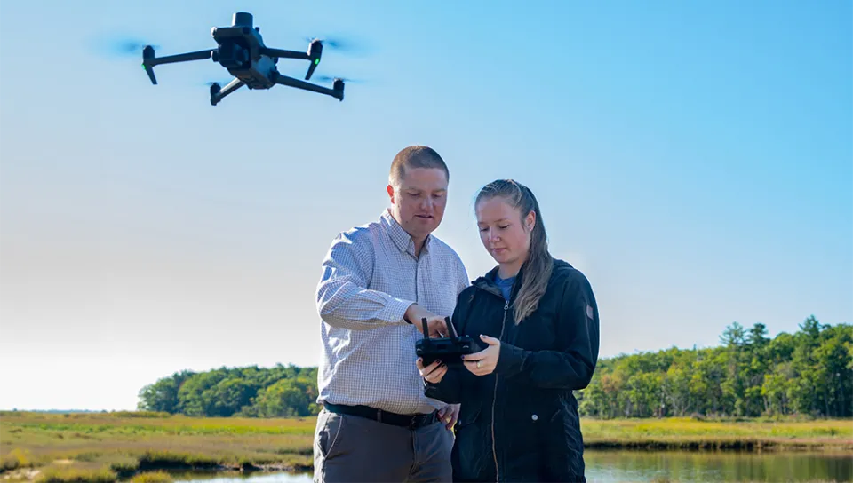
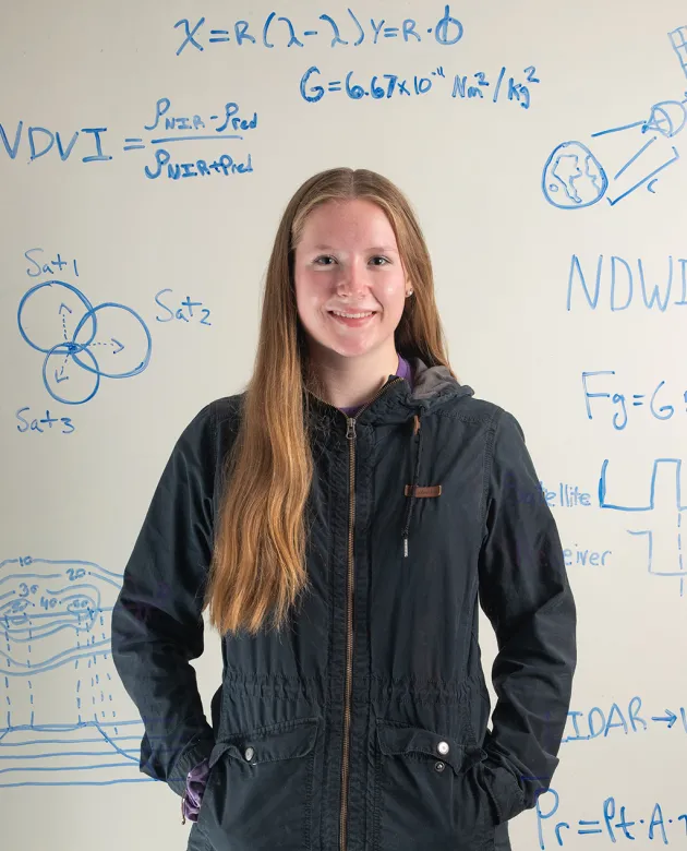
Left photo of Johanna Birchem (Environmental Science, ’26) with Will Kotchtitzky (left) flying a drone on the Rachel Carson National Wildlife Refuge. Right photo of Katie DeWater surrounded by her GIS research.
DeWater works closely with UNE’s Will Kochtitzky, Ph.D., an assistant professor in the School of Marine and Environmental Programs, whose research delves into the complexities of marsh restoration and dune preservation. In Kochtitzky’s lab, DeWater uses drones, remote sensing, and GIS, a computer-based tool for storing, analyzing, interpreting, and visualizing geographic data, to map and plot a dozen coastal wetlands, called salt marshes, across southern Maine.
Partnering with researchers at the Rachel Carson National Wildlife Refuge (NWR), DeWater and Kochtitzky work to provide aerial perspectives of these salt marshes to better understand their current state and measure, in real time, as progress is made toward their restoration.
We have been going out to fly the drone about once a week during the low tides to fly over the marshes and collect elevation models and imagery to complement our time series data set,” DeWater said.
The dataset, which goes back to 2009, helps DeWater assess how rising sea levels affect marsh pools. She explained that drone images taken along a transect line are stitched together with software to create a detailed image of the marsh.
As the sea level rises, salt marshes have difficulty adapting, said Kochtitzky. In Maine and the Northeast, “mega-pools” — which are large areas of too much water — kill the plants that grow there. Salt marshes and their ecosystems capture and store carbon, which helps combat climate change, and without healthy vegetation, the marshes can’t do their jobs as effectively, he explained.
“We need to stay alert because the rate of change we’re experiencing is unprecedented in geologic history,” said Kochtitzky.
Humble GIS Mapping Beginnings
As the leader of UNE’s Geographic Information Systems (GIS) program, Kochtitzky was thrilled when DeWater took an interest in his class as a first-year student.
“Katie DeWater is incredibly impressive,” he said. “She is extremely competent and dedicated to her studies and research.”
At the start of Dewater’s guided study, she explored ways to incorporate GIS mapping into an ongoing research project and planned to map the Biddeford Pool marsh adjacent to the Biddeford Campus, owned by individuals and organizations, including UNE.
Kochtitzky quickly realized that the scope of this project alone was insufficient for DeWater’s thirst for knowledge, so the pair set to mapping all the extensive salt marshes along southern Maine’s coast.
“(GIS) is such a powerful tool and skill because you can look at a global scale of changing systems, zoom in, and look over a temporal scale way back to the 1950s,” she said, adding that comparing and analyzing data between regions spatially is vital to any mapping research.
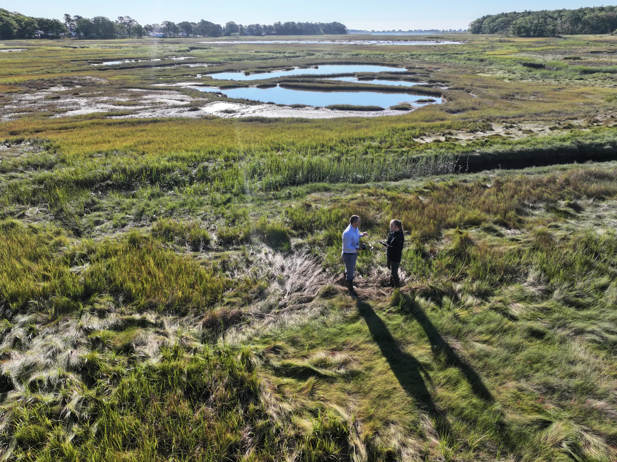
Stemming from student enthusiasm and commitment to GIS research, like DeWater’s, Kochtitzky’s Coastal Research Lab came to fruition. The lab has secured nearly $1 million in total grant funding to UNE and partners from the Maine Natural Resource Conservation Program and the Maine Space Grant Consortium to use GIS mapping for marsh restoration efforts.
Susan C. Adamowicz, Ph.D., a land management research and demonstration biologist with the U.S. Fish and Wildlife Service, said engaging with the University to restore salt marshes has brought fresh perspectives and enthusiasm to the project.
“It is important to engage with the next generation, whether or not they become scientists, so that at least they will be more informed citizens,” said Adamowicz, whose office manages Rachel Carson NWR.
The lab is now home to five undergraduate student researchers using drones and GIS technology to map marshes and beaches. While DeWater’s research represents a newer aspect of salt marsh studies at UNE, it builds on UNE’s long-standing legacy of marsh restoration efforts and collaborative endeavors.
Pam Morgan, Ph.D., UNE professor of environmental studies, has involved University students in salt marsh research projects since the early 2000s. Morgan and her students have investigated a wide range of topics, from the impact of oil spills to the functional differences between small fringing marshes and larger meadow marshes. Recently, her students have concentrated on coastal erosion in the salt marshes and riverbanks along the Biddeford Campus, aiming to develop a sustainable “living shoreline.”
Morgan explains that monitoring the marshes from the air is an important step in the latest restoration efforts.
“Will and Katie’s GIS research and aerial mappings provide important information for scientists at Rachel Carson National Wildlife Refuge and go hand-in-hand with the ecology-based restoration work on the ground,” she said.
Most of Kochtitzky’s previous research has focused on the Canadian Arctic, where hardly anyone lives, but now he and his lab are actively engaging with local communities rather than staying solely in the academic world. He said it’s rewarding to address the rise in sea level as a problem for those directly affected.
“It’s really fulfilling to make a difference here in Maine,” he said.
Kochtitzky, who has been at UNE since 2022, is a highly accomplished researcher having authored over 30 peer-reviewed publications with only eight years in academia. He is known for his significant contributions to his field and student research opportunities, said Stine Brown, Ph.D. UNE’s interim dean of the College of Arts and Sciences and professor of biology.
“Dr. Kochtitzky is recognized as one of the University’s rising scholars among the faculty, and it’s exciting to see him mentor our next generation of conservation researchers,” Brown said. “His actions as a faculty member embody the dedication to teaching and learning and to engaging students in collaborative research that maximizes the impact of this work on UNE students, other faculty researchers, community members, and organizations.”
Growing Community Connections
Over the past decade, Maine winters, particularly along the coast, have experienced more rain and wind than snow. This was especially apparent last winter when two major rainstorms led to historic coastal flooding and record-breaking high tides throughout much of the state. According to DeWater, salt marshes are particularly important during these large storms because they can provide a buffer area over which the tides and excess water can go instead of being directly forced onto developed areas and homes. Marshes also absorb the energy of incoming waves.
“With these recent storm surges and record-breaking tides, the marshes became completely inundated and underwater,” she remarked. “The longer marshes have these complete submersions, the more erosion we see as they are exposed to wave action and currents.”
Given the trends of past Maine winters, DeWater and other students in Kochtitzky’s Coastal Research Lab anticipated a growing need for mapping the area. The group mapped and monitored the coastal marshes and beaches in the fall before the January storms.
Kochtitzky acknowledges that his team was lucky to have completed drone flights ahead of these storm surges.
“My students are creating lasting impacts in the Saco, Biddeford, and Kennebunkport communities,” he said. “For the past six months, they have been comparing before and after imagery of these coastal systems.”
Since the storms, local community members have contacted Kochtitzky seeking data and information related to their properties. DeWater attributes the University’s prime location and strong reputation to its positive impact on the region.
“I love being a student researcher at UNE because our lab frequently communicates and collaborates with the community,” she said, adding that a Goose Rocks Beach resident, whose house is mainly surrounded by marshland, asked the lab for before-and-after images of their property to better assess how they can start to rebuild. The lab provided drone data and surveys the previous year, showing a significant storm impact on their pier.
These images and data play a crucial role in helping local community members evaluate the extent of the damage and make informed decisions on rebuilding and fortifying their properties against future storms. “We have participated in numerous group meetings and engage with local residents to learn about their experiences and discover how our lab can support them,” DeWater said.
In addition to their ongoing partnership with the Rachel Carson NWR, the Coastal Research Lab works with many local groups, such as Save Our Shores Saco Bay and the Biddeford Coastal Preservation Coalition.
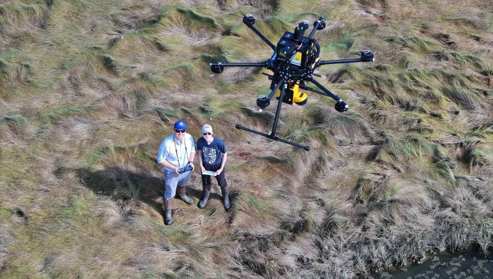
Expanding GIS Mapping Research
DeWater’s marsh restoration research has evolved with her advancing GIS mapping skills to include surveying the beachfront for sand dune loss, specifically identifying which types of dunes and coastal structures held together better during recent storm surges.
According to DeWater, the larger and healthier the dunes in front of residents’ homes on the coast, the more resilient they are to sea level rise and withstanding these ever-intensifying storms.
“The dunes are sort of like the first line of defense, and then the marshes come behind them for backup,” DeWater said.
Natural dunes can be a long-term defense against storms but erode without sand on the beach or wash away in powerful storms. DeWater plans to use her study to promote artificial dunes that mimic natural ones.
“To prepare for future storms, we’re obviously trying to look at rebuilding damaged dunes from the wreckage they faced this past winter, but we are also trying to identify what coast type is the most resilient to storms so that we can focus our attention to those areas,” she said, noting that community members can better protect their homes with diagonal dune paths from their houses to the beach.
DeWater’s dedication to research has certainly not gone unnoticed. This past spring, she was one of just three recipients from Maine to be awarded the prestigious Barry Goldwater Scholarship for 2024.
In addition to engaging students in the research, Kochtitzky said he is looking at ways to expand DeWater’s GIS modeling momentum, further incorporate the fieldwork across the curriculum, and involve new faculty members.
“I look forward to seeing how we continue to partner with our community and biologists at Rachel Carson to use restoration techniques and GIS mapping to make a difference,” she said, adding that even after she graduates and goes on to graduate school, UNE students will be able to use her drone photography to examine coastal change over time, and she hopes students will take on the challenge of mapping the marsh pools in the future.
“Maybe it’s boots on the ground planting new native vegetation, runnelling to create small drainage channels in the marsh, or working with Pam Morgan and her living shoreline research to improve hydrology,” she said. “I am excited to see this work and research continue.”
